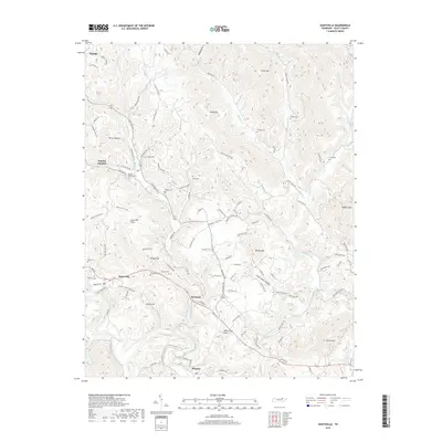
2019 Map of Huntsville
USGS Topo · Published 2019About this map
Huntsville and the surrounding Scott County landscape are defined by a complex network of ridges and hollows, where family history is deeply etched into the topography. The settlement pattern follows the winding paths of Buffalo Creek and the New River, with clusters of heritage sites like Buttram Cem and Chambers Cem marking the legacy of local residents. The map reveals a transition from the busier corridors near Oneida and Stanley Junction to the more secluded terrain of Ditney Mtn and Silcox Mtn. The inclusion of Litton Covered Bridge Rd highlights a specific cultural landmark in the valley near Litton Hill, while numerous cemeteries such as Pumpkin Hollow Cem and Griffin Cem offer precise locations for genealogical research. This map details how the rugged Appalachian geography influenced the placement of small communities like Newtown and Winona along the creek beds and gap crossings.
Find a feature on this map
116 named features on this map. Tap any name to fly to it.
Don’t see what you’re looking for? This feature index may not catch every label — zoom into the map to look around manually.
Map Details
Editions of this 2019 Huntsville Map
This is the sole edition of this map. No revisions or reprints were ever made.
Other maps of this area

1890 · Williamsburg
USGS Topo · 1:125,000

1893 · Briceville
USGS Topo · 1:125,000

1894 · Williamsburg
USGS Topo · 1:125,000

1895 · Wartburg
USGS Topo · 1:125,000

1895 · Briceville
USGS Topo · 1:125,000

1896 · Wartburg
USGS Topo · 1:125,000

1896 · Briceville
USGS Topo · 1:125,000

1934 · Barthell
USGS Topo · 1:62,500

1936 · Block
USGS Topo · 1:24,000

1936 · Pioneer
USGS Topo · 1:24,000