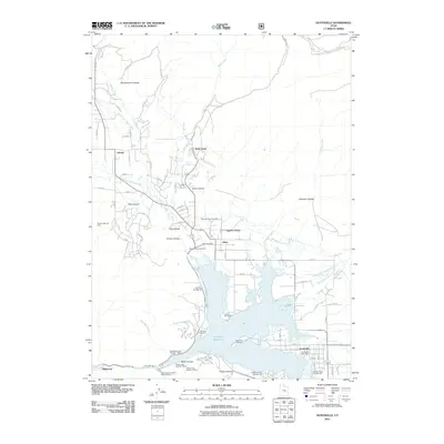
2011 Map of Huntsville
USGS Topo · Published 2011About this map
Huntsville and Eden anchor the lower reaches of Ogden Valley, where the waters of the Middle Fork Ogden River and South Fork Wolf Creek converge into the expansive Pineview Reservoir. This 2011 survey documents a landscape of high-elevation recreation and small mountain settlements. Local history is deeply rooted in the several burial grounds scattered throughout the valley, including Mountain View Cemetery, Meadow View Cemetery, and Huntsville Cemetery.
Find a feature on this map
76 named features on this map. Tap any name to fly to it.
Don’t see what you’re looking for? This feature index may not catch every label — zoom into the map to look around manually.
Map Details
Editions of this 2011 Huntsville Map
This is the sole edition of this map. No revisions or reprints were ever made.
Other maps of this area

1954 · Ogden
USGS Topo · 1:250,000

1955 · Ogden
USGS Topo · 1:24,000

1955 · Mantua
USGS Topo · 1:24,000

1955 · Huntsville
USGS Topo · 1:24,000

1955 · James Peak
USGS Topo · 1:24,000

1955 · North Ogden
USGS Topo · 1:24,000

1955 · Snow Basin
USGS Topo · 1:24,000

1958 · Ogden
USGS Topo · 1:250,000

1960 · Ogden
USGS Topo · 1:250,000

1961 · Morgan
USGS Topo · 1:62,500