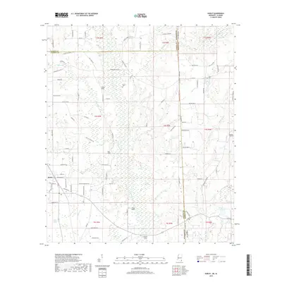
2018 Map of Hurley
USGS Topo · Published 2018About this map
The Escatawpa River defines the central corridor of this coastal plain landscape on the Mississippi-Alabama border, winding through a network of wetlands and bluffs. Significant elevation changes are marked by Yellow Bluff, Red Bluff, and White Bluff along the river's western bank, while the low-lying eastern terrain is characterized by features like Devils Den Bay and Black Creek Swamp. The settlement of Hurley serves as the primary local hub, supported by a dense grid of family-named roads such as Joe Rubino Rd and Coleman Homestead Rd. For genealogists and local historians, the map identifies specific burial sites including Tanners Cem and Joyner Cem. Transportation and infrastructure are represented by Browns Bridge crossing the river and the Skywest Airpark located near the state line, reflecting the area's mix of rural homesteads and modern aviation access.
Find a feature on this map
93 named features on this map. Tap any name to fly to it.
Don’t see what you’re looking for? This feature index may not catch every label — zoom into the map to look around manually.
Map Details
Editions of this 2018 Hurley Map
This is the sole edition of this map. No revisions or reprints were ever made.
Other maps of this area

1941 · Hurley
USGS Topo · 1:62,500

1941 · Vancleave
USGS Topo · 1:62,500

1941 · Lucedale
USGS Topo · 1:62,500

1942 · Wilmer
USGS Topo · 1:62,500

1943 · Lucedale
USGS Topo · 1:62,500

1943 · Hurley
USGS Topo · 1:62,500

1943 · Vancleave
USGS Topo · 1:62,500

1944 · Wilmer
USGS Topo · 1:62,500

1944 · Vancleave
USGS Topo · 1:62,500

1953 · Mobile
USGS Topo · 1:250,000