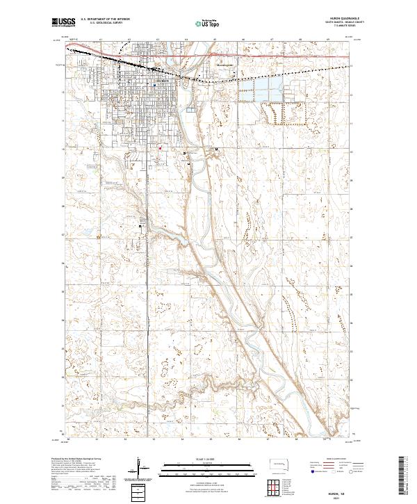
2021 Map of Huron
USGS Topo · Published 2021About this map
Huron serves as the regional hub of Beadle County, centered around its grid-patterned streets and the Beadle County Courthouse. The city's geography is defined by its position along the meandering James River, which flows south through the center of the quadrangle. Significant for genealogical research, the map documents several burial grounds including Riverside Cem, Saint Martin Cem, and Ideal Cem located along the river bluffs. To the east, the community of Morningside sits just north of the residential expansion. The surrounding landscape is characterized by the prairie hydrology of Cain Cr and Pearl Cr, illustrating the transition from the concentrated urban core of Huron to the expansive agricultural sections and range lines that extend toward the county borders.
Find a feature on this map
118 named features on this map. Tap any name to fly to it.
Don’t see what you’re looking for? This feature index may not catch every label — zoom into the map to look around manually.
Map Details
Editions of this 2021 Huron Map
This is the sole edition of this map. No revisions or reprints were ever made.
Other maps of this area

1898 · Huron
USGS Topo · 1:125,000

1953 · Huron
USGS Topo · 1:250,000

1954 · Huron
USGS Topo · 1:250,000

1957 · Forestburg NE
USGS Topo · 1:24,000

1957 · Cavour
USGS Topo · 1:24,000

1957 · Huron
USGS Topo · 1:24,000

1958 · Forestburg NW
USGS Topo · 1:24,000

1958 · Huron NW
USGS Topo · 1:24,000
1958 · Huron NE
USGS Topo · 1:24,000

1973 · Alpena
USGS Topo · 1:24,000