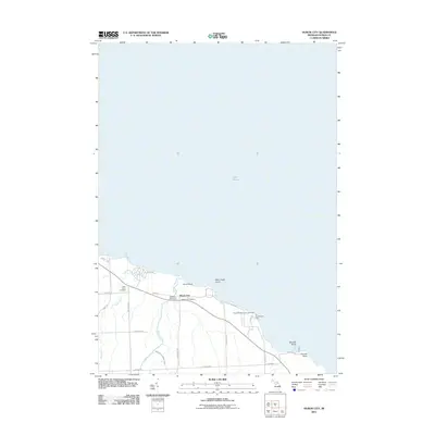
2011 Map of Huron City
USGS Topo · Published 2011About this map
Lake Huron dominates this coastal survey, where the rugged shoreline of Michigan's Thumb meets the lighthouse-guarded points of Huron City. The area's maritime and pioneer history is anchored by the Pointe Aux Barques Lighthouse and the Huron City Museum, marking a landscape defined by its relation to the water. Inward from the rocky outcrops of Orion Rock and Bald Eagle Point, the land is drained by the New River and Willow Creek, which flow through a network of rural roads such as Pioneer and Parisville Rd.
Find a feature on this map
29 named features on this map. Tap any name to fly to it.
Don’t see what you’re looking for? This feature index may not catch every label — zoom into the map to look around manually.
Map Details
Editions of this 2011 Huron City Map
This is the sole edition of this map. No revisions or reprints were ever made.
Other maps of this area

1954 · Flint
USGS Topo · 1:250,000

1954 · Tawas City
USGS Topo · 1:250,000

1958 · Flint
USGS Topo · 1:250,000

1958 · Tawas City
USGS Topo · 1:250,000

1970 · Port Hope
USGS Topo · 1:24,000

1970 · Port Austin East
USGS Topo · 1:24,000

1970 · Kinde East
USGS Topo · 1:24,000

1970 · Redman
USGS Topo · 1:24,000

1970 · Huron City
USGS Topo · 1:24,000

1984 · Harbor Beach
USGS Topo · 1:100,000