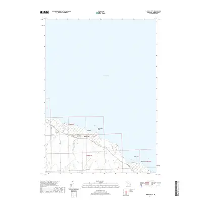
2019 Map of Huron City
USGS Topo · Published 2019About this map
Huron City sits at the northern tip of Michigan's Thumb, where the waters of Lake Huron meet a coastline defined by rocky outcroppings and subtle stream outlets. This area preserves a quiet maritime and agricultural character, evidenced by the presence of New River Cem and Hubbard Memorial Cem near the historic townsite. Drainage patterns are shaped by the New River and Willow Creek, including the S Br Willow Cr, which flow through the lowlands before reaching the lake. Along the shore, distinct geographic markers like Orion Rock and Bald Eagle Point break the coastline, while local routes such as Lakeshore Rd and Pioneer Rd connect the scattered homesteads and legacy landmarks of Port Austin Township.
Find a feature on this map
32 named features on this map. Tap any name to fly to it.
Don’t see what you’re looking for? This feature index may not catch every label — zoom into the map to look around manually.
Map Details
Editions of this 2019 Huron City Map
This is the sole edition of this map. No revisions or reprints were ever made.
Other maps of this area

1954 · Flint
USGS Topo · 1:250,000

1954 · Tawas City
USGS Topo · 1:250,000

1958 · Flint
USGS Topo · 1:250,000

1958 · Tawas City
USGS Topo · 1:250,000

1970 · Port Hope
USGS Topo · 1:24,000

1970 · Port Austin East
USGS Topo · 1:24,000

1970 · Kinde East
USGS Topo · 1:24,000

1970 · Redman
USGS Topo · 1:24,000

1970 · Huron City
USGS Topo · 1:24,000

1984 · Harbor Beach
USGS Topo · 1:100,000