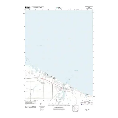
2010 Map of Huron
USGS Topo · Published 2010About this map
The Lake Erie shoreline in Erie County defines the character of Huron, where the river mouth and lakeside are dotted with seasonal and residential developments. This 2010 survey details the transition from the lakefront beaches, such as Nickel Plate Beach and Lake Park Street Beach, to the academic and recreational grounds further inland. The presence of the Bowling Green State University Fireland Campus and the James H McBride Arboretum marks a significant educational corridor, while the Huron Airport and Hinde Airport provide small-scale aviation access to this coastal region.
Find a feature on this map
32 named features on this map. Tap any name to fly to it.
Don’t see what you’re looking for? This feature index may not catch every label — zoom into the map to look around manually.
Map Details
Editions of this 2010 Huron Map
This is the sole edition of this map. No revisions or reprints were ever made.
Other maps of this area

1903 · Vermilion
USGS Topo · 1:62,500

1904 · Sandusky
USGS Topo · 1:62,500

1916 · Kelleys Island
USGS Topo · 1:62,500

1919 · Kelleys Island
USGS Topo · 1:62,500

1956 · Toledo
USGS Topo · 1:250,000

1959 · Kimball
USGS Topo · 1:24,000

1959 · Milan
USGS Topo · 1:24,000

1959 · Sandusky
USGS Topo · 1:24,000

1959 · Berlin Heights
USGS Topo · 1:24,000

1959 · Vermilion West
USGS Topo · 1:24,000