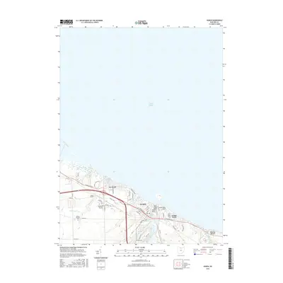
2016 Map of Huron
USGS Topo · Published 2016About this map
The Huron waterfront along Lake Erie defines this 2016 survey, showing a landscape shaped by coastal residential development and education. The city center is framed by the Huron River to the east and the Bowling Green State University-Firelands campus to the west. This modern topography reveals how the shoreline has been organized into distinct beach communities, from Rye Beach and Chaska Beach to Oberlin Beach at the eastern edge. Local aviation is represented by Hinde Airport, while the interior drainage is managed through a network of waterways including Sawmill Creek, Dautch Ditch, and Boos Ditch. Public spaces and memorial grounds like Restlawn Memorial Park and the centrally located Huron Cemetery provide important points of reference for local genealogy and land-use studies.
Find a feature on this map
37 named features on this map. Tap any name to fly to it.
Don’t see what you’re looking for? This feature index may not catch every label — zoom into the map to look around manually.
Map Details
Editions of this 2016 Huron Map
This is the sole edition of this map. No revisions or reprints were ever made.
Other maps of this area

1903 · Vermilion
USGS Topo · 1:62,500

1904 · Sandusky
USGS Topo · 1:62,500

1916 · Kelleys Island
USGS Topo · 1:62,500

1919 · Kelleys Island
USGS Topo · 1:62,500

1956 · Toledo
USGS Topo · 1:250,000

1959 · Kimball
USGS Topo · 1:24,000

1959 · Milan
USGS Topo · 1:24,000

1959 · Sandusky
USGS Topo · 1:24,000

1959 · Berlin Heights
USGS Topo · 1:24,000

1959 · Vermilion West
USGS Topo · 1:24,000