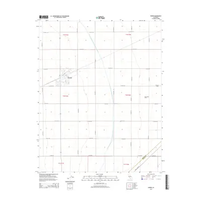
2015 Map of Huron
USGS Topo · Published 2015About this map
The agricultural grid of the San Joaquin Valley is the defining feature of this 2015 study, centered on the town of Huron. The landscape is dominated by a systematic network of section roads like S Madera Ave and W Jayne Ave, which partition the fertile Central Valley floor. A massive piece of water infrastructure, the Governor Edmund G Brown California Aqueduct, bisects the region from north to south, illustrating the engineering required to sustain industrial-scale farming in this arid environment. Near the southern edge, the Fresno Co Kings Co boundary line runs through open fields just north of the Avenal Cutoff Rd, marking the geopolitical transition between these two prominent agricultural counties.
Find a feature on this map
34 named features on this map. Tap any name to fly to it.
Don’t see what you’re looking for? This feature index may not catch every label — zoom into the map to look around manually.
Map Details
Editions of this 2015 Huron Map
This is the sole edition of this map. No revisions or reprints were ever made.
Other maps of this area

1912 · Coalinga
USGS Topo · 1:125,000

1926 · Lethent
USGS Topo · 1:31,680

1928 · Delta Farms No 3
USGS Topo · 1:31,680

1929 · Westhaven
USGS Topo · 1:31,680

1930 · Discovery Well
USGS Topo · 1:31,680

1930 · Canoas Creek
USGS Topo · 1:31,680

1932 · Delta Farms
USGS Topo · 1:31,680

1932 · West of Lethent
USGS Topo · 1:31,680

1933 · Kettleman City
USGS Topo · 1:31,680

1933 · Huron
USGS Topo · 1:31,680