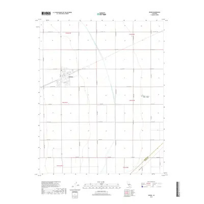
2018 Map of Huron
USGS Topo · Published 2018About this map
Huron serves as the primary municipal center for this section of the San Joaquin Valley, situated within the broader expanse of the Central Valley. The town's grid is characterized by numbered streets like 11th St and 4th St, as well as named thoroughfares such as W Tornado Ave. A critical piece of infrastructure, the Governor Edmund G Brown California Aqueduct, bisects the landscape diagonally from northwest to southeast, illustrating the managed water systems vital to this agricultural region. The map also captures the boundary where Fresno Co meets Kings Co at its southern edge, near the intersection of Avenal Cutoff Rd and 31st Ave. This survey documents a landscape defined by large-scale rectilinear land divisions and a strictly organized network of farm-to-market roads.
Find a feature on this map
33 named features on this map. Tap any name to fly to it.
Don’t see what you’re looking for? This feature index may not catch every label — zoom into the map to look around manually.
Map Details
Editions of this 2018 Huron Map
This is the sole edition of this map. No revisions or reprints were ever made.
Other maps of this area

1912 · Coalinga
USGS Topo · 1:125,000

1926 · Lethent
USGS Topo · 1:31,680

1928 · Delta Farms No 3
USGS Topo · 1:31,680

1929 · Westhaven
USGS Topo · 1:31,680

1930 · Discovery Well
USGS Topo · 1:31,680

1930 · Canoas Creek
USGS Topo · 1:31,680

1932 · Delta Farms
USGS Topo · 1:31,680

1932 · West of Lethent
USGS Topo · 1:31,680

1933 · Kettleman City
USGS Topo · 1:31,680

1933 · Huron
USGS Topo · 1:31,680