2021 Map of Huron
USGS Topo · Published 2021About this map
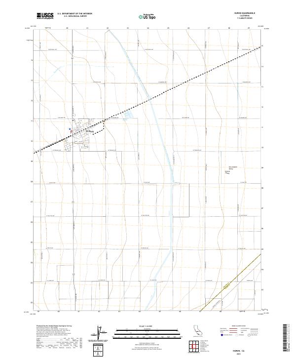
Huron anchors this agricultural landscape within the San Joaquin Valley, appearing here in the early 21st century. The town is defined by a precise grid of streets including 11th St and 4th St, surrounded by a massive expanse of irrigated fields in the Central Valley. The industrial scale of the regional water infrastructure is evident in the Governor Edmund G Brown California Aqueduct, which cuts diagonally across the terrain to the north and east of the settlement. To the northwest, the natural drainage of Los Gatos Cr provides a contrast to the engineered precision of the aqueduct. The southern portion of the map reveals the jurisdictional boundary between Fresno Co and Kings Co, intersected by the long diagonal of Avenal Cutoff Rd. This survey reflects the modern geometry of California's primary farming belt, where vast section lines and named avenues dictate the movement of goods and water.
Find a feature on this map
36 named features on this map. Tap any name to fly to it.
Don’t see what you’re looking for? This feature index may not catch every label — zoom into the map to look around manually.
Map Details
Editions of this 2021 Huron Map
This is the sole edition of this map. No revisions or reprints were ever made.
Historical Maps of Airway Farms Through Time
4 maps found