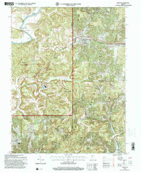
1993 Map of Huron
USGS Topo · Published 1998About this map
The East Fork of the White River carves the northern boundary of this landscape, creating sharp topographic turns such as Norman Rock Bend and Devils Elbow. Centered around the settlement of Huron, the map illustrates a region defined by the intersection of the B & O RR and the rugged drainage basins of Beaver Creek and its South Fork. Significant portions of the land are dedicated to the Martin State Forest and the Hoosier National Forest, reflecting a late-twentieth-century balance between timber management and rural habitation.
Find a feature on this map
33 named features on this map. Tap any name to fly to it.
Don’t see what you’re looking for? This feature index may not catch every label — zoom into the map to look around manually.
Map Details
Editions of this 1993 Huron Map
4 editions found
Other maps of this area

1935 · Oolitic
USGS Topo · 1:48,000

1942 · Oolitic
USGS Topo · 1:62,500

1948 · Huron
USGS Topo · 1:24,000

1949 · Georgia
USGS Topo · 1:24,000

1950 · Huron
USGS Topo · 1:24,000

1950 · Shoals
USGS Topo · 1:24,000

1951 · Hillham
USGS Topo · 1:24,000

1951 · French Lick
USGS Topo · 1:24,000

1951 · Georgia
USGS Topo · 1:24,000

1956 · Rusk
USGS Topo · 1:24,000