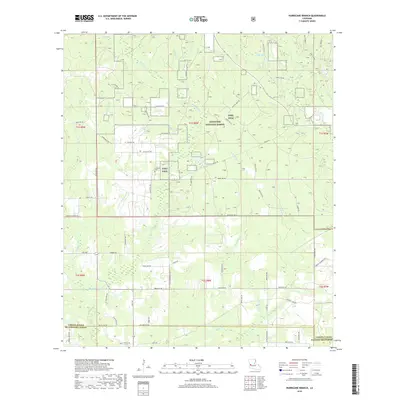
2018 Map of Hurricane Branch
USGS Topo · Published 2018About this map
Kisatchie National Forest dominates this section of Vernon Parish, where a dense network of tributaries drains into the Bundick Cr and Black Cr systems. The landscape is heavily influenced by the military operations of Fort Polk, which occupies much of the central and northern terrain. This coexistence of federal forest land and military training grounds is reflected in the road network, which transitions from named parish routes like Lockhart Cutoff Rd to specific boundary markers such as W Boundary Rd and S Boundry Rd. Genealogists and local historians can locate the Johnson Cem situated near Providence Rd, while numerous family names are preserved on the local landscape through thoroughfares like J P Calcote Rd, Bill Churchman Loop, and B Ashworth Rd, providing a clear record of local land occupancy and movement in the 21st century.
Find a feature on this map
72 named features on this map. Tap any name to fly to it.
Don’t see what you’re looking for? This feature index may not catch every label — zoom into the map to look around manually.
Map Details
Editions of this 2018 Hurricane Branch Map
This is the sole edition of this map. No revisions or reprints were ever made.
Other maps of this area

1941 · Leesville
USGS Topo · 1:62,500

1941 · Slagle
USGS Topo · 1:62,500

1943 · Leesville
USGS Topo · 1:62,500

1944 · Slagle
USGS Topo · 1:62,500

1946 · Leesville
USGS Topo · 1:62,500

1947 · DeRidder
USGS Topo · 1:31,680

1947 · Rosepine
USGS Topo · 1:31,680

1947 · Ikes
USGS Topo · 1:31,680

1947 · Chasmore
USGS Topo · 1:31,680

1947 · Sugartown
USGS Topo · 1:31,680