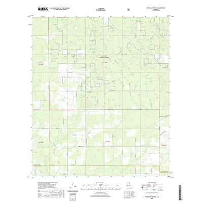
2020 Map of Hurricane Branch
USGS Topo · Published 2020About this map
Kisatchie National Forest dominates this landscape on the border of Vernon and Beauregard Parishes. The terrain is defined by a dense network of watercourses, including the central Bundick Cr and its many tributaries such as Hurricane Br, Tighteye Cr, and Rocky Br. Military history and land management are visible through the proximity of Fort Polk and the extensive grid of parish roads that navigate the timberlands. Local history is anchored at the Johnson Cem, located near the junction of Bailey Rd and Ida Bailey Rd. The map illustrates the specialized road system used for forest management, featuring named routes like Providence Rd and Walter James Rd. These roads connect isolated drainage basins and timber plots, while larger thoroughfares like Ikes Rd and Parish Rd 758 provide the primary east-west transit across the southern reaches of the quadrangle.
Find a feature on this map
80 named features on this map. Tap any name to fly to it.
Don’t see what you’re looking for? This feature index may not catch every label — zoom into the map to look around manually.
Map Details
Editions of this 2020 Hurricane Branch Map
This is the sole edition of this map. No revisions or reprints were ever made.
Other maps of this area

1941 · Leesville
USGS Topo · 1:62,500

1941 · Slagle
USGS Topo · 1:62,500

1943 · Leesville
USGS Topo · 1:62,500

1944 · Slagle
USGS Topo · 1:62,500

1946 · Leesville
USGS Topo · 1:62,500

1947 · DeRidder
USGS Topo · 1:31,680

1947 · Rosepine
USGS Topo · 1:31,680

1947 · Ikes
USGS Topo · 1:31,680

1947 · Chasmore
USGS Topo · 1:31,680

1947 · Sugartown
USGS Topo · 1:31,680