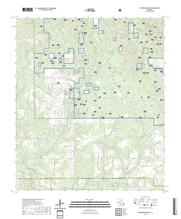
2024 Map of Hurricane Branch
USGS Topo · Published 2024About this map
Kisatchie National Forest defines the northern reaches of this territory, where the landscape is carved by a dense network of tributaries including Bundick Creek and the namesake Hurricane Branch. The map reveals a transition from managed forest lands to the military infrastructure of Fort Polk, which occupies a significant portion of the central and western sections. This area serves as a critical watershed, where numerous creeks like Slaughter Branch and Yoke Creek drain southward toward the parish boundary.
Find a feature on this map
74 named features on this map. Tap any name to fly to it.
Don’t see what you’re looking for? This feature index may not catch every label — zoom into the map to look around manually.
Map Details
Editions of this 2024 Hurricane Branch Map
This is the sole edition of this map. No revisions or reprints were ever made.
Other maps of this area

1941 · Leesville
USGS Topo · 1:62,500

1941 · Slagle
USGS Topo · 1:62,500

1943 · Leesville
USGS Topo · 1:62,500

1944 · Slagle
USGS Topo · 1:62,500

1946 · Leesville
USGS Topo · 1:62,500

1947 · DeRidder
USGS Topo · 1:31,680

1947 · Rosepine
USGS Topo · 1:31,680

1947 · Ikes
USGS Topo · 1:31,680

1947 · Chasmore
USGS Topo · 1:31,680

1947 · Sugartown
USGS Topo · 1:31,680