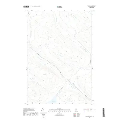
2021 Map of Hurricane Hill
USGS Topo · Published 2021About this map
Hurricane Hill dominates this remote landscape in the north woods of Somerset County along the Usa-Canada border. The terrain is defined by an intricate network of waterways including the Middle Br Norris Brook and the S Br Norris Brook, which drain the timberlands of the Saint-Zacharie region. Transportation is dictated by industrial timber routes, most notably the Golden Rd, which cuts diagonally across the quadrangle. This critical thoroughfare links the isolated drainage basins of Hurricane Brook and Roberts Brook. To the south, Dole Pond serves as a significant hydrologic feature, fed by the Dole Brook. The map illustrates a modern era of forest management where accessibility is provided by specialized routes like Dole Pond Rd and Morris Brook Rd, reflecting the ongoing economic importance of the borderland's natural resources.
Find a feature on this map
11 named features on this map. Tap any name to fly to it.
Don’t see what you’re looking for? This feature index may not catch every label — zoom into the map to look around manually.
Map Details
Editions of this 2021 Hurricane Hill Map
This is the sole edition of this map. No revisions or reprints were ever made.
Other maps of this area

1927 · Sandy Bay
USGS Topo · 1:48,000

1930 · Sandy Bay
USGS Topo · 1:62,500

1944 · Sandy Bay
USGS Topo · 1:62,500

1949 · Jackman
USGS Topo · 1:250,000

1956 · Penobscot Lake
USGS Topo · 1:62,500

1957 · Norris Brook
USGS Topo · 1:62,500

1957 · Saint Zacharie
USGS Topo · 1:62,500

1962 · Quebec
USGS Topo · 1:250,000

1963 · Jackman
USGS Topo · 1:250,000

1966 · Sherbrooke
USGS Topo · 1:250,000