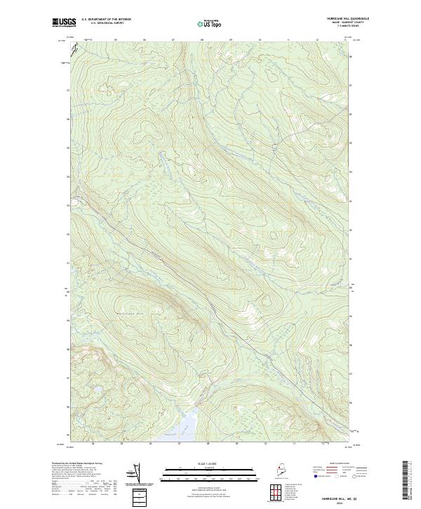
2024 Map of Hurricane Hill
USGS Topo · Published 2024About this map
Hurricane Hill dominates this interior landscape of Somerset County, Maine, situated just south of the international border between Canada and the United States. The drainage patterns here are defined by several remote waterways, including Hurricane Brook and Roberts Brook, which flow through heavily timbered upland terrain. The presence of the Golden Rd—a legendary private logging road—running northwest-to-southeast through the center of the sheet indicates the area's continued role in the state's commercial forest industry.
Find a feature on this map
11 named features on this map. Tap any name to fly to it.
Don’t see what you’re looking for? This feature index may not catch every label — zoom into the map to look around manually.
Map Details
Editions of this 2024 Hurricane Hill Map
This is the sole edition of this map. No revisions or reprints were ever made.
Other maps of this area

1927 · Sandy Bay
USGS Topo · 1:48,000

1930 · Sandy Bay
USGS Topo · 1:62,500

1944 · Sandy Bay
USGS Topo · 1:62,500

1949 · Jackman
USGS Topo · 1:250,000

1956 · Penobscot Lake
USGS Topo · 1:62,500

1957 · Norris Brook
USGS Topo · 1:62,500

1957 · Saint Zacharie
USGS Topo · 1:62,500

1962 · Quebec
USGS Topo · 1:250,000

1963 · Jackman
USGS Topo · 1:250,000

1966 · Sherbrooke
USGS Topo · 1:250,000