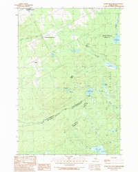
1989 Map of Hurricane Pond
USGS Topo · Published 1989About this map
Saint-Zacharie and Lavery anchor this international borderland where Somerset County meets Quebec. The landscape is defined by the headwaters of the St John River Southwest Branch, including Little St John Lake, and an intricate network of drainage basins. This 1980s-era survey reveals a heavily managed timberland, evidenced by numerous gates, private roads, and gravel pits scattered across the terrain.
Find a feature on this map
36 named features on this map. Tap any name to fly to it.
Don’t see what you’re looking for? This feature index may not catch every label — zoom into the map to look around manually.
Map Details
Editions of this 1989 Hurricane Pond Map
This is the sole edition of this map. No revisions or reprints were ever made.
Other maps of this area

1927 · Sandy Bay
USGS Topo · 1:48,000

1930 · Sandy Bay
USGS Topo · 1:62,500

1944 · Sandy Bay
USGS Topo · 1:62,500

1949 · Jackman
USGS Topo · 1:250,000

1956 · Penobscot Lake
USGS Topo · 1:62,500

1957 · Norris Brook
USGS Topo · 1:62,500

1957 · Saint Zacharie
USGS Topo · 1:62,500

1962 · Quebec
USGS Topo · 1:250,000

1963 · Jackman
USGS Topo · 1:250,000

1966 · Sherbrooke
USGS Topo · 1:250,000