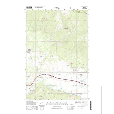
2017 Map of Huson
USGS Topo · Published 2017About this map
The Clark Fork river valley anchors this study of Missoula County, where the sprawling boundaries of the Lolo National Forest meet the agricultural and residential corridors near Huson and Frenchtown. The landscape is defined by the sharp transition from the river bottom to the high peaks of the Reservation Divide, including the prominent Edith Peak at the northern edge. Evidence of the area's water management is visible through the Frenchtown Irrigation District Ditch, which follows the contours of the valley floor above the river. Local topography is marked by features like Cayuse Hill and French Gulch, while a dense network of forest and rural roads, such as Edith Peak Rd and Nine Mile Rd, provides access into the surrounding mountain drainages of Sixmile Cr and Roman Cr.
Find a feature on this map
67 named features on this map. Tap any name to fly to it.
Don’t see what you’re looking for? This feature index may not catch every label — zoom into the map to look around manually.
Map Details
Editions of this 2017 Huson Map
This is the sole edition of this map. No revisions or reprints were ever made.
Other maps of this area

1912 · Missoula
USGS Topo · 1:125,000

1956 · Wallace
USGS Topo · 1:250,000

1956 · Hamilton
USGS Topo · 1:250,000

1959 · Hamilton
USGS Topo · 1:250,000

1959 · Alberton
USGS Topo · 1:62,500

1959 · Arlee
USGS Topo · 1:62,500

1960 · Wallace
USGS Topo · 1:250,000

1960 · Hamilton
USGS Topo · 1:250,000

1963 · Primrose
USGS Topo · 1:24,000

1964 · Hamilton
USGS Topo · 1:250,000