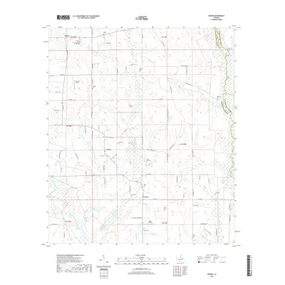
2018 Map of Husser
USGS Topo · Published 2018About this map
Husser and Osceola anchor this part of Tangipahoa Parish, where the land transitions from the pine-flats of the northern parish into the wetlands of the Buzzards Roost Swamp. The landscape is defined by the headwaters and tributaries of the Tchefuncte River, which forms the eastern boundary with Washington and St. Tammany Parishes. This area shows a persistent pattern of rural settlement, characterized by numerous family-named cemeteries such as Saint Rock Cem, Bahm Cem, and Brown Cem scattered along the local road network. The presence of Sycamore Airport near Holton and the river access at Goose Landing illustrate the diverse ways residents have navigated this wooded terrain. Numerous creeks, including Spring Cr and Snow Cr, weave through the townships, supporting the small-scale agricultural and timber interests that have historically shaped this region.
Find a feature on this map
99 named features on this map. Tap any name to fly to it.
Don’t see what you’re looking for? This feature index may not catch every label — zoom into the map to look around manually.
Map Details
Editions of this 2018 Husser Map
This is the sole edition of this map. No revisions or reprints were ever made.
Other maps of this area

1940 · Tickfaw
USGS Topo · 1:31,680

1942 · Onville
USGS Topo · 1:31,680

1942 · Husser
USGS Topo · 1:31,680

1942 · Robert
USGS Topo · 1:31,680

1942 · Wilmer
USGS Topo · 1:31,680

1942 · Loranger
USGS Topo · 1:31,680

1949 · Bolivar
USGS Topo · 1:31,680

1950 · Folsom
USGS Topo · 1:31,680

1950 · Franklinton
USGS Topo · 1:31,680

1954 · Folsom
USGS Topo · 1:62,500