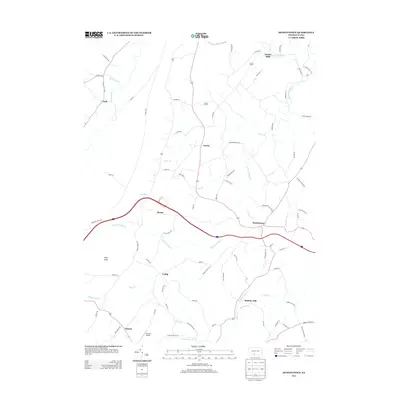
2013 Map of Hustontown
USGS Topo · Published 2013About this map
Dublin Mills and Mellotts Mill anchor a landscape defined by the winding drainages of the northern Appalachians. This 2013 survey documents a predominantly rural region of Fulton County where historic crossroads settlements like Hustontown and Laidig persist along a network of secondary roads. The topography is shaped by the parallel flow of Sideling Hill Cr and Wooden Bridge Cr, with King Knob rising as a prominent landmark in the western portion of the quadrangle. Small-scale aviation is represented by the Flying R Airport near Saluvia, reflecting the modern integration of the landscape. The distribution of family-named roads, such as N Madden Rd and W Frick Rd, suggests a deep-rooted local history tied to original land tracts and agricultural homesteads that have shaped the area's development over generations.
Find a feature on this map
81 named features on this map. Tap any name to fly to it.
Don’t see what you’re looking for? This feature index may not catch every label — zoom into the map to look around manually.
Map Details
Editions of this 2013 Hustontown Map
This is the sole edition of this map. No revisions or reprints were ever made.
Other maps of this area

1900 · Mercersburg
USGS Topo · 1:62,500

1902 · Mercersburg
USGS Topo · 1:62,500

1925 · Needmore
USGS Topo · 1:48,000

1930 · Broad Top
USGS Topo · 1:62,500

1933 · Broad Top
USGS Topo · 1:62,500

1935 · Needmore
USGS Topo · 1:62,500

1939 · Needmore
USGS Topo · 1:62,500

1939 · Orbisonia
USGS Topo · 1:62,500

1940 · Orbisonia
USGS Topo · 1:62,500

1942 · Hagerstown
USGS Topo · 1:125,000
Featured Places
- Laidig, Taylor Township
- Hustontown, Dublin Township
- Licking Creek Township, PA
- Springfield Township, PA
- Clay Township, PA