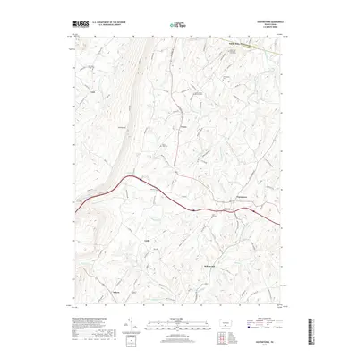
2019 Map of Hustontown
USGS Topo · Published 2019About this map
Sideling Hill dominates the western edge of this terrain, where the Sideling Hill Tunnel serves as a major transit point through the ridge. The landscape transitions into a series of small agricultural and rural settlements such as Laidig, Hustontown, and Dublin Mills near the Huntingdon and Fulton county line. The drainage pattern is defined by several waterways, including Wooden Bridge Creek, Lick Run, and Sideling Hill Creek, which support small-scale local industry like Mellotts Mill.
Find a feature on this map
92 named features on this map. Tap any name to fly to it.
Don’t see what you’re looking for? This feature index may not catch every label — zoom into the map to look around manually.
Map Details
Editions of this 2019 Hustontown Map
This is the sole edition of this map. No revisions or reprints were ever made.
Other maps of this area

1900 · Mercersburg
USGS Topo · 1:62,500

1902 · Mercersburg
USGS Topo · 1:62,500

1925 · Needmore
USGS Topo · 1:48,000

1930 · Broad Top
USGS Topo · 1:62,500

1933 · Broad Top
USGS Topo · 1:62,500

1935 · Needmore
USGS Topo · 1:62,500

1939 · Needmore
USGS Topo · 1:62,500

1939 · Orbisonia
USGS Topo · 1:62,500

1940 · Orbisonia
USGS Topo · 1:62,500

1942 · Hagerstown
USGS Topo · 1:125,000
Featured Places
- Laidig, Taylor Township
- Hustontown, Dublin Township
- Licking Creek Township, PA
- Springfield Township, PA
- Clay Township, PA