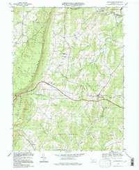
1994 Map of Hustontown
USGS Topo · Published 1997About this map
Hustontown serves as a primary hub for the rural Dublin and Taylor townships, positioned where the Pennsylvania Turnpike cuts across the ridge-and-valley landscape. The map reveals a community defined by its watercourses and gaps, with the Sideling Hill State Forest dominating the western topography. Local education and religious life are well-documented through landmarks like the Forbes Road High Sch, Mt Tabor Ch, and Fairview Ch, which are scattered throughout the agricultural clearings between forested slopes.
Find a feature on this map
46 named features on this map. Tap any name to fly to it.
Don’t see what you’re looking for? This feature index may not catch every label — zoom into the map to look around manually.
Map Details
Editions of this 1994 Hustontown Map
This is the sole edition of this map. No revisions or reprints were ever made.
Other maps of this area

1900 · Mercersburg
USGS Topo · 1:62,500

1902 · Mercersburg
USGS Topo · 1:62,500

1925 · Needmore
USGS Topo · 1:48,000

1930 · Broad Top
USGS Topo · 1:62,500

1933 · Broad Top
USGS Topo · 1:62,500

1935 · Needmore
USGS Topo · 1:62,500

1939 · Needmore
USGS Topo · 1:62,500

1939 · Orbisonia
USGS Topo · 1:62,500

1940 · Orbisonia
USGS Topo · 1:62,500

1942 · Hagerstown
USGS Topo · 1:125,000
Featured Places
- Mellotts Mill, Licking Creek Township
- Laidig, Taylor Township
- Saluvia, Licking Creek Township
- Enid, Wells Township
- Licking Creek Township, PA