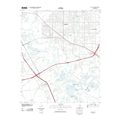
2010 Map of Hutchins
USGS Topo · Published 2010About this map
The Trinity River corridor southeast of Dallas defines this landscape, where the floodplain's natural complexity meets the expanding urban grid of Balch Springs and Hutchins. A string of private sporting and recreational waters—including Fin and Feather Club Lake, Lancaster Club Lake, and the Dallas Hunting and Fishing Club Lake—line the river's eastern banks, highlighting the area's long-standing use for outdoor leisure near the city. Further inland, established neighborhoods are served by the Pleasant Grove Post Office and bordered by significant green spaces like Lincoln Memorial Park and Samuell-Crawford Memorial Park. Historical land use is visible in the presence of Carver Cemetery and the localized aviation activity at Culp Airport. The transportation network is anchored by several major highways and local thoroughfares like S Augustine Rd and Dowdy Ferry Rd, which connect the outlying settlements of Rylie and Kleberg to the metropolitan center.
Find a feature on this map
60 named features on this map. Tap any name to fly to it.
Don’t see what you’re looking for? This feature index may not catch every label — zoom into the map to look around manually.
Map Details
Editions of this 2010 Hutchins Map
This is the sole edition of this map. No revisions or reprints were ever made.
Other maps of this area

1891 · Dallas
USGS Topo · 1:125,000

1893 · Dallas
USGS Topo · 1:125,000

1931 · Carrollton
USGS Topo · 1:62,500

1954 · Dallas
USGS Topo · 1:250,000

1957 · White Rock Lake
USGS Topo · 1:24,000

1958 · Dallas
USGS Topo · 1:250,000

1958 · Hutchins
USGS Topo · 1:24,000

1958 · Oak Cliff
USGS Topo · 1:24,000

1958 · Dallas
USGS Topo · 1:24,000

1958 · White Rock Lake
USGS Topo · 1:24,000