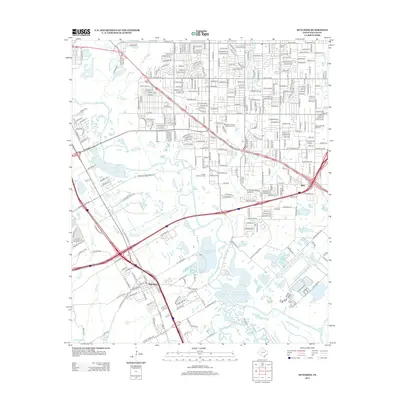
2012 Map of Hutchins
USGS Topo · Published 2012About this map
The town of Hutchins serves as a focal point in this 2012 study of the southern Dallas corridor, where the historic Trinity River bottomlands meet modern transportation infrastructure. The landscape is defined by the heavy presence of private recreational water bodies and conservation areas, including the Fin and Feather Club Lake, Lancaster Club Lake, and the Dallas Hunting and Fishing Club Lake. These sites, situated alongside Gravel Slough and Prairie Cr, illustrate a long-standing tradition of river-adjacent sporting clubs that have persisted despite the encroaching urban grid.
Find a feature on this map
69 named features on this map. Tap any name to fly to it.
Don’t see what you’re looking for? This feature index may not catch every label — zoom into the map to look around manually.
Map Details
Editions of this 2012 Hutchins Map
This is the sole edition of this map. No revisions or reprints were ever made.
Other maps of this area

1891 · Dallas
USGS Topo · 1:125,000

1893 · Dallas
USGS Topo · 1:125,000

1931 · Carrollton
USGS Topo · 1:62,500

1954 · Dallas
USGS Topo · 1:250,000

1957 · White Rock Lake
USGS Topo · 1:24,000

1958 · Dallas
USGS Topo · 1:250,000

1958 · Hutchins
USGS Topo · 1:24,000

1958 · Oak Cliff
USGS Topo · 1:24,000

1958 · Dallas
USGS Topo · 1:24,000

1958 · White Rock Lake
USGS Topo · 1:24,000