2024 Map of Hutsonville
USGS Topo · Published 2024About this map
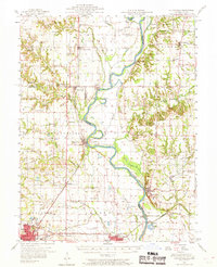
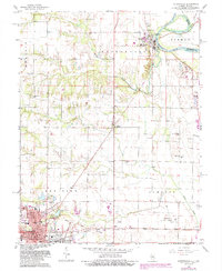
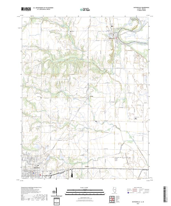
The Wabash River forms the natural eastern boundary of this Crawford County landscape, where the Hutsonville Cut Off and Kelley Bayou create a complex riparian environment near the Illinois-Indiana border. The settlement of Hutsonville is positioned along the riverbank, while the interior is dotted with rural hamlets like Trimble and Gordon. This survey shows a high density of ancestral sites for local researchers, including the Old Hutsonville Cem, Ball Cem, and Newlin Cem, indicating a long history of family settlement across the tillable land between Hutson Creek and Sugar Creek. To the southwest, the regional hub of Robinson features the county Courthouse and is bordered by Lincoln Trail College and the Crawford County Airport, illustrating the balance between the area's agricultural roots and its modern institutional infrastructure.
Find a feature on this map
85 named features on this map. Tap any name to fly to it.
Don’t see what you’re looking for? This feature index may not catch every label — zoom into the map to look around manually.
Map Details
Editions of this 2024 Hutsonville Map
This is the sole edition of this map. No revisions or reprints were ever made.
Historical Maps of Robinson Through Time
8 maps found