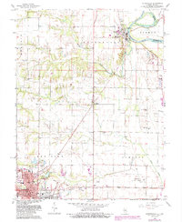
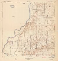
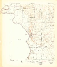
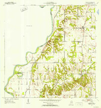
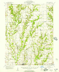
1966 Map of Hutsonville
USGS Topo · Published 1987About this map
The Indian Treaty Boundary cuts diagonally across the landscape of Crawford County, Illinois, providing a historical anchor for this mid-1960s survey. To the south, the city of Robinson serves as a major hub, its street grid detailed with landmarks like the Courthouse, Washington School, and the Post Office. The urban area contrasts with the winding course of the Wabash River to the northeast, where the Hutsonville Cutoff and Bayou reflect the shifting hydrology of the border between Indiana and Illinois. Transport networks of the era are well-defined, from the Illinois Central Gulf railroad line to the Robinson Municipal Airport. Rural life is centered around several country churches and family-named burial grounds, including Barbee Cemetery and Newlin Cemetery, alongside smaller settlements like Trimble and Hutsonville.
Find a feature on this map
49 named features on this map. Tap any name to fly to it.
Don’t see what you’re looking for? This feature index may not catch every label — zoom into the map to look around manually.
Map Details
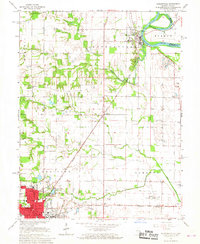
Editions of this 1966 Hutsonville Map
2 editions found
Other maps of this area
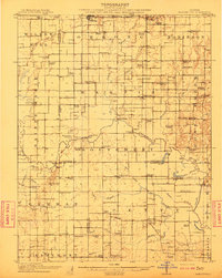
1910 · Hardinville
USGS Topo · 1:62,500
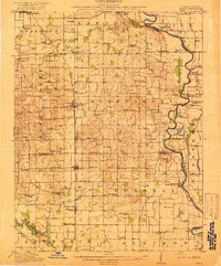
1917 · Birds
USGS Topo · 1:62,500
1942 · Fairbanks
USGS Topo · 1:24,000

1942 · Birds
USGS Topo · 1:62,500
1943 · Merom
USGS Topo · 1:24,000
1952 · Fairbanks
USGS Topo · 1:24,000

1953 · Indianapolis
USGS Topo · 1:250,000

1956 · Indianapolis
USGS Topo · 1:250,000
1956 · Annapolis
USGS Topo · 1:62,500

1956 · Vincennes
USGS Topo · 1:250,000