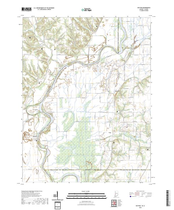
2022 Map of Hutton
USGS Topo · Published 2022About this map
The Wabash River meanders across the border of Illinois and Indiana, carving a complex landscape of backwaters and bends such as Aurora Bend and Blue Hole. This riverine environment is defined by its oxbows and marshy lowlands, including Muskrat Pond, Little Grassy Pond, and the elongated Oxendine Bayou. The settlement of Darwin sits on the western bank, while the community of Hutton is positioned further inland to the east.
Find a feature on this map
100 named features on this map. Tap any name to fly to it.
Don’t see what you’re looking for? This feature index may not catch every label — zoom into the map to look around manually.
Map Details
Editions of this 2022 Hutton Map
This is the sole edition of this map. No revisions or reprints were ever made.
Other maps of this area

1932 · Marshall
USGS Topo · 1:62,500

1937 · Marshall
USGS Topo · 1:62,500

1940 · Pimento
USGS Topo · 1:24,000

1941 · Terre Haute
USGS Topo · 1:24,000

1942 · Fairbanks
USGS Topo · 1:24,000

1942 · Shelburn
USGS Topo · 1:24,000

1942 · Hutton
USGS Topo · 1:24,000

1942 · Dennison
USGS Topo · 1:24,000

1948 · Terre Haute
USGS Topo · 1:24,000

1952 · Fairbanks
USGS Topo · 1:24,000