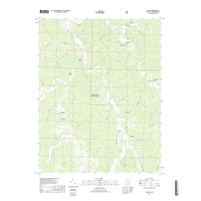
2017 Map of Huzzah
USGS Topo · Published 2017About this map
Westover Fisheries and the settlement of Westover sit at the western edge of this territory, where Westover Spring feeds into the winding Huzzah Creek. This landscape is defined by its dramatic hydrology, featuring prominent geologic markers like the Lower Narrows and Upper Narrows along the creek's path through the Mark Twain National Forest. The map reveals a high density of named hollows and springs, such as Hickman Spring, James Spring, and Keener Hollow, indicating a terrain where water sources dictated early settlement patterns.
Find a feature on this map
78 named features on this map. Tap any name to fly to it.
Don’t see what you’re looking for? This feature index may not catch every label — zoom into the map to look around manually.
Map Details
Editions of this 2017 Huzzah Map
This is the sole edition of this map. No revisions or reprints were ever made.
Other maps of this area

1903 · Sullivan
USGS Topo · 1:125,000

1932 · Steelville
USGS Topo · 1:48,000

1933 · Steelville
USGS Topo · 1:62,500

1937 · Steelville
USGS Topo · 1:62,500

1943 · Berryman
USGS Topo · 1:62,500

1945 · Berryman
USGS Topo · 1:62,500

1947 · Sullivan
USGS Topo · 1:62,500

1948 · Leasburg
USGS Topo · 1:24,000

1949 · Saint Louis
USGS Topo · 1:250,000

1949 · Sullivan
USGS Topo · 1:62,500