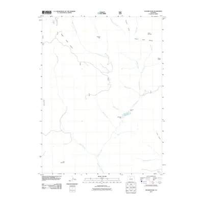
2011 Map of Hyannis Peak
USGS Topo · Published 2011About this map
Hendricks Ranch sits at the heart of this high-elevation landscape in the Rabbit Ears Range, where the headwaters of numerous creeks converge. The terrain is defined by dramatic peaks and ridgelines, including Hyannis Peak, Sheep Mountain, and the prominent Arapaho Ridge. Water management is central to the area's geography, evidenced by the Matheson Dam and Matheson Reservoir, which capture runoff from Porphyry Creek and Troublesome Creek. The map documents a complex network of drainage basins, with the Middle Fork Arapaho Creek and East Fork Arapaho Creek flowing north while Rabbit Ears Creek and Glomerate Creek carve paths through the southern reaches. This 2011 survey captures the intersection of natural resources and high-country ranching, from the slopes of Coal Mountain to the eastern extent of Poison Ridge.
Find a feature on this map
31 named features on this map. Tap any name to fly to it.
Don’t see what you’re looking for? This feature index may not catch every label — zoom into the map to look around manually.
Map Details
Editions of this 2011 Hyannis Peak Map
This is the sole edition of this map. No revisions or reprints were ever made.
Other maps of this area

1954 · Craig
USGS Topo · 1:250,000

1956 · Kremmling
USGS Topo · 1:62,500

1956 · Spicer Peak
USGS Topo · 1:24,000

1956 · Parkview Mountain
USGS Topo · 1:24,000

1956 · Buffalo Peak
USGS Topo · 1:24,000

1956 · Whiteley Peak
USGS Topo · 1:24,000

1956 · Hyannis Peak
USGS Topo · 1:24,000

1956 · Rand
USGS Topo · 1:24,000

1956 · Hyannis Peak
USGS Topo · 1:62,500

1956 · Rand
USGS Topo · 1:62,500