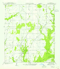
1955 Map of Hyatt
USGS Topo · Published 1955About this map
Hyatt and the nearby Fields P. O. serve as the primary landmarks in this southwestern Louisiana landscape, which is heavily defined by its industrial history and drainage network. The presence of numerous sections of an Old Logging Railroad Grade indicates the area's significance to the timber industry, showing how transport lines once carved through the dense creek bottoms. These remnants of the logging era are interspersed among a complex system of waterways, including the winding Bear Head Creek, Brushy Creek, and Windham Creek.
Find a feature on this map
15 named features on this map. Tap any name to fly to it.
Don’t see what you’re looking for? This feature index may not catch every label — zoom into the map to look around manually.
Map Details
Editions of this 1955 Hyatt Map
This is the sole edition of this map. No revisions or reprints were ever made.
Other maps of this area

1935 · Wilson Lake
USGS Topo · 1:31,680

1947 · Singer
USGS Topo · 1:31,680

1947 · Carter Creek
USGS Topo · 1:31,680

1947 · DeQuincy
USGS Topo · 1:31,680

1947 · Oretta
USGS Topo · 1:31,680

1947 · Wilson Lake
USGS Topo · 1:31,680

1947 · Hyatt
USGS Topo · 1:31,680

1947 · Bivens
USGS Topo · 1:31,680

1947 · Long Marsh
USGS Topo · 1:31,680

1949 · Bancroft
USGS Topo · 1:31,680