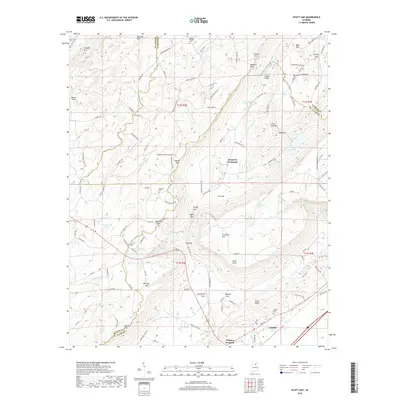
2018 Map of Hyatt Gap
USGS Topo · Published 2018About this map
Ashville and the surrounding ridgelines of St. Clair County are defined by a series of parallel mountains and deep coves. The terrain transitions from Straight Mtn and Raccoon Mtn in the northwest toward the high elevation of Chandler Mtn in the center, creating natural gaps such as Battle Gap and Hyatt Gap. This topography shaped the area's development, concentrating settlements at intersections like Ferguson Crossroad and Whitney Junction. Local history is preserved in several family and community burial grounds, including the Mauldin Cem and Choate Cem. Water resources are abundant throughout the valleys, from the larger Locust Fork and Lake Sumatanga to smaller streams like Muckleroy Cr and Little Gulf Br. The presence of Robbins Field near the northern boundary and multiple mountain-top features like Yellow Bluff and Point Peter further illustrate the diverse use of this Alabama landscape.
Find a feature on this map
123 named features on this map. Tap any name to fly to it.
Don’t see what you’re looking for? This feature index may not catch every label — zoom into the map to look around manually.
Map Details
Editions of this 2018 Hyatt Gap Map
This is the sole edition of this map. No revisions or reprints were ever made.
Other maps of this area

1885 · Gadsden
USGS Topo · 1:125,000

1888 · Gadsden
USGS Topo · 1:125,000

1889 · Springville
USGS Topo · 1:125,000

1892 · Springville
USGS Topo · 1:125,000

1892 · Gadsden
USGS Topo · 1:125,000

1895 · Gadsden
USGS Topo · 1:125,000

1903 · Gadsden
USGS Topo · 1:125,000

1947 · Cox Gap
USGS Topo · 1:24,000

1947 · Steele
USGS Topo · 1:24,000

1947 · Steele
USGS Topo · 1:62,500