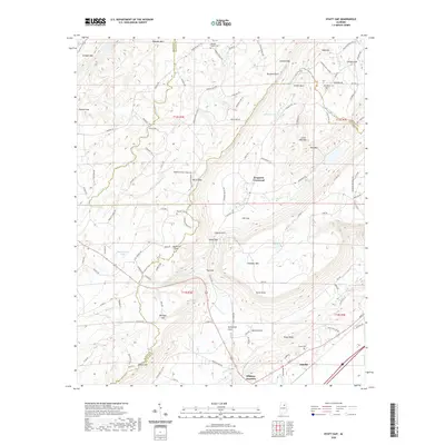
2020 Map of Hyatt Gap
USGS Topo · Published 2020About this map
Ashville and the surrounding ridgelines of St. Clair County are defined by a complex series of gaps and coves where the Appalachian foothills meet local valleys. This landscape is a corridor of historical movement, marked by passages such as Hyatt Gap, Battle Gap, and Awtreys Gap that cut through the prominent elevations of Blount Mtn and Chandler Mtn. The settlement pattern follows these natural openings, with local hubs like Ferguson Crossroad and Whitney Junction serving as focal points for the rural road network. High points like Yellow Bluff and Point Peter overlook the fertile basins of Greasy Cove and Beason Cove, while the headwaters of Little Canoe Creek and the Locust Fork drain the north-central terrain. Genealogists will find several family and community landmarks, including Moody Chapel Cem, Bethlehem Cem, and Choate Cem, which anchor the historic agrarian communities of this region.
Find a feature on this map
124 named features on this map. Tap any name to fly to it.
Don’t see what you’re looking for? This feature index may not catch every label — zoom into the map to look around manually.
Map Details
Editions of this 2020 Hyatt Gap Map
This is the sole edition of this map. No revisions or reprints were ever made.
Other maps of this area

1885 · Gadsden
USGS Topo · 1:125,000

1888 · Gadsden
USGS Topo · 1:125,000

1889 · Springville
USGS Topo · 1:125,000

1892 · Springville
USGS Topo · 1:125,000

1892 · Gadsden
USGS Topo · 1:125,000

1895 · Gadsden
USGS Topo · 1:125,000

1903 · Gadsden
USGS Topo · 1:125,000

1947 · Cox Gap
USGS Topo · 1:24,000

1947 · Steele
USGS Topo · 1:24,000

1947 · Steele
USGS Topo · 1:62,500