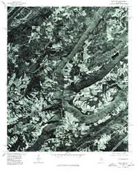
1975 Map of Hyatt Gap
USGS Topo · Published 1977About this map
The ridge-and-valley terrain of Hyatt Gap takes center stage in this orthophotoquad, which uses aerial photography from 1975 to provide a literal view of the St. Clair County landscape. Unlike traditional line-drawn topographic maps, this imagery reveals the exact patterns of timber clearing, agricultural fields, and wooded slopes as they existed in the mid-1970s. The distinct geological folds of the Appalachian foothills are visible through the high-altitude photography, showing the relationship between the steep, forested ridges and the winding valley roads that navigate the gap. Produced in cooperation with the Soil Conservation Service, this document captures the land-use patterns of north-central Alabama before modern expansion, offering a clear record of the area's rural character and natural drainage systems.
Find a feature on this map
1 named feature on this map. Tap any name to fly to it.
Don’t see what you’re looking for? This feature index may not catch every label — zoom into the map to look around manually.
Map Details
Editions of this 1975 Hyatt Gap Map
This is the sole edition of this map. No revisions or reprints were ever made.
Other maps of this area

1885 · Gadsden
USGS Topo · 1:125,000

1888 · Gadsden
USGS Topo · 1:125,000

1889 · Springville
USGS Topo · 1:125,000

1892 · Springville
USGS Topo · 1:125,000

1892 · Gadsden
USGS Topo · 1:125,000

1895 · Gadsden
USGS Topo · 1:125,000

1903 · Gadsden
USGS Topo · 1:125,000

1947 · Cox Gap
USGS Topo · 1:24,000

1947 · Steele
USGS Topo · 1:24,000

1947 · Steele
USGS Topo · 1:62,500