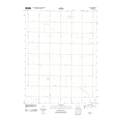
2010 Map of Hyde
USGS Topo · Published 2010About this map
Hyde serves as the quiet center of this eastern Colorado landscape, where the high plains are defined by a strict grid of county roads and essential water sources. The area's history is anchored by the Hyde Cemetery and the presence of the Hyde Oil Field, which points to the underlying energy resources that have shaped the local economy. Water management is critical in this environment, as evidenced by the course of Surveyor Creek and the localized basin of Deering Lake to the north. Transportation and logistics are tied to the rail corridor in the southeast corner, marked by the Yuma Siding, illustrating how this remote settlement remains connected to broader trade networks even decades after its peak settlement era.
Find a feature on this map
23 named features on this map. Tap any name to fly to it.
Don’t see what you’re looking for? This feature index may not catch every label — zoom into the map to look around manually.
Map Details
Editions of this 2010 Hyde Map
This is the sole edition of this map. No revisions or reprints were ever made.
Other maps of this area

1954 · Sterling
USGS Topo · 1:250,000

1958 · Sterling
USGS Topo · 1:250,000

1972 · Otis
USGS Topo · 1:24,000

1972 · Hyde
USGS Topo · 1:24,000

1972 · Lone Star
USGS Topo · 1:24,000

1972 · Clarkville SW
USGS Topo · 1:24,000

1972 · Snyder Lake
USGS Topo · 1:24,000

1972 · Otis SE
USGS Topo · 1:24,000

1972 · Burdett
USGS Topo · 1:24,000

1972 · Yuma South
USGS Topo · 1:24,000