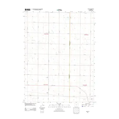
2013 Map of Hyde
USGS Topo · Published 2013About this map
Hyde serves as a central anchor for this High Plains landscape, situated along the Us-34 E corridor. This era reflects a landscape structured by a precise grid of rural roads, including CO Road YY and CO Road 41, which facilitate access to the surrounding agricultural and industrial sites. The presence of the Hyde Oil Field to the north of the main settlement indicates the regional reliance on natural resources, while the Hyde Cem stands as a focal point for local genealogy. The eastern edge of the quadrangle is defined by the boundary between Washington County and Yuma County. Natural features are sparse but significant, with the intermittent drainage of Surveyor Creek and the localized depression of Deering Lake providing the only breaks in the geometric surveying of the plains. Near the southern edge, the Yuma Siding marks the importance of rail transit to this rural Colorado community.
Find a feature on this map
28 named features on this map. Tap any name to fly to it.
Don’t see what you’re looking for? This feature index may not catch every label — zoom into the map to look around manually.
Map Details
Editions of this 2013 Hyde Map
This is the sole edition of this map. No revisions or reprints were ever made.
Other maps of this area

1954 · Sterling
USGS Topo · 1:250,000

1958 · Sterling
USGS Topo · 1:250,000

1972 · Otis
USGS Topo · 1:24,000

1972 · Hyde
USGS Topo · 1:24,000

1972 · Lone Star
USGS Topo · 1:24,000

1972 · Clarkville SW
USGS Topo · 1:24,000

1972 · Snyder Lake
USGS Topo · 1:24,000

1972 · Otis SE
USGS Topo · 1:24,000

1972 · Burdett
USGS Topo · 1:24,000

1972 · Yuma South
USGS Topo · 1:24,000