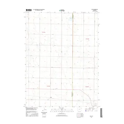
2016 Map of Hyde
USGS Topo · Published 2016About this map
Hyde anchors this High Plains landscape along the boundary line shared by Washington and Yuma counties. The small settlement is situated near the Hyde Cem, which serves as a significant landmark for those researching regional family history and the early ranching communities of eastern Colorado. This 2016 survey illustrates a strictly grid-based transportation network defined by routes such as Co RD 42 and Co RD YY, reflecting the systematic land divisions typical of this prairie region. Natural water features are scarce in this dry terrain, making the presence of Deering Lake and the drainage of Surveyor Cr notable exceptions to the surrounding upland topography. The map provides a precise account of rural infrastructure, including isolated structures and property lines across townships like t3n r49w and t2n r48w.
Find a feature on this map
26 named features on this map. Tap any name to fly to it.
Don’t see what you’re looking for? This feature index may not catch every label — zoom into the map to look around manually.
Map Details
Editions of this 2016 Hyde Map
This is the sole edition of this map. No revisions or reprints were ever made.
Other maps of this area

1954 · Sterling
USGS Topo · 1:250,000

1958 · Sterling
USGS Topo · 1:250,000

1972 · Otis
USGS Topo · 1:24,000

1972 · Hyde
USGS Topo · 1:24,000

1972 · Lone Star
USGS Topo · 1:24,000

1972 · Clarkville SW
USGS Topo · 1:24,000

1972 · Snyder Lake
USGS Topo · 1:24,000

1972 · Otis SE
USGS Topo · 1:24,000

1972 · Burdett
USGS Topo · 1:24,000

1972 · Yuma South
USGS Topo · 1:24,000