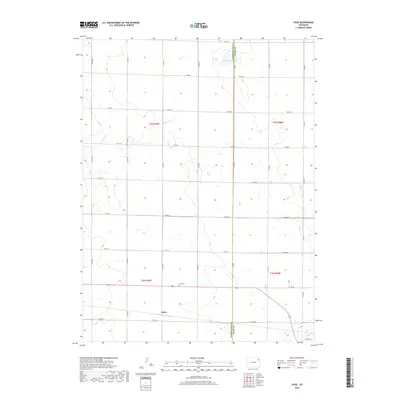
2019 Map of Hyde
USGS Topo · Published 2019About this map
Hyde anchors this portion of the eastern Colorado plains, situated along the border of Washington Co and Yuma Co. The landscape is defined by the expansive grid of county roads, such as Co RD 44 and Co RD WW, which partition the high prairie into surveyed sections. Notable water features include Surveyor Cr, which winds through the northwestern reaches, and Deering Lake positioned along the county line to the north. For those researching local heritage, the Hyde Cem stands as a central landmark just north of the settlement. The map illustrates a strictly organized agricultural environment where the placement of small drainage features and rural intersections reflects a late twentieth-century infrastructure supporting the remote ranching and farming operations of the region.
Find a feature on this map
22 named features on this map. Tap any name to fly to it.
Don’t see what you’re looking for? This feature index may not catch every label — zoom into the map to look around manually.
Map Details
Editions of this 2019 Hyde Map
This is the sole edition of this map. No revisions or reprints were ever made.
Other maps of this area

1954 · Sterling
USGS Topo · 1:250,000

1958 · Sterling
USGS Topo · 1:250,000

1972 · Otis
USGS Topo · 1:24,000

1972 · Hyde
USGS Topo · 1:24,000

1972 · Lone Star
USGS Topo · 1:24,000

1972 · Clarkville SW
USGS Topo · 1:24,000

1972 · Snyder Lake
USGS Topo · 1:24,000

1972 · Otis SE
USGS Topo · 1:24,000

1972 · Burdett
USGS Topo · 1:24,000

1972 · Yuma South
USGS Topo · 1:24,000