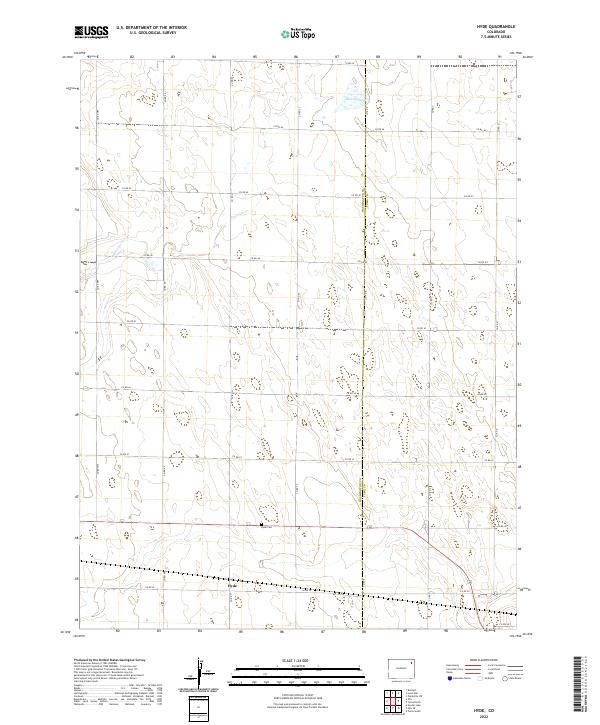
2022 Map of Hyde
USGS Topo · Published 2022About this map
Hyde sits along the southern edge of this map, serving as a primary point of reference in an area defined by the straight lines of the High Plains road grid. The boundary between Washington Co and Yuma Co runs vertically through the center, marking a administrative divide in this agricultural landscape. To the north, Deering Lake and the drainage of Surveyor Cr provide the only significant breaks in the topography. Genealogists will find the Hyde Cem located north of the main settlement along Co RD 40, a small but vital landmark for family history in this corner of Colorado. The map reflects a landscape organized by section lines, with gravel roads like Co RD 39 and Co RD 47 providing the essential infrastructure for the surrounding ranching and farming operations.
Find a feature on this map
26 named features on this map. Tap any name to fly to it.
Don’t see what you’re looking for? This feature index may not catch every label — zoom into the map to look around manually.
Map Details
Editions of this 2022 Hyde Map
This is the sole edition of this map. No revisions or reprints were ever made.
Other maps of this area

1954 · Sterling
USGS Topo · 1:250,000

1958 · Sterling
USGS Topo · 1:250,000

1972 · Otis
USGS Topo · 1:24,000

1972 · Hyde
USGS Topo · 1:24,000

1972 · Lone Star
USGS Topo · 1:24,000

1972 · Clarkville SW
USGS Topo · 1:24,000

1972 · Snyder Lake
USGS Topo · 1:24,000

1972 · Otis SE
USGS Topo · 1:24,000

1972 · Burdett
USGS Topo · 1:24,000

1972 · Yuma South
USGS Topo · 1:24,000