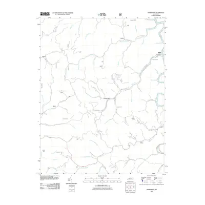
2011 Map of Hyden West
USGS Topo · Published 2011About this map
Thousandsticks and Sizerock anchor this survey of Leslie County's Cumberland Plateau landscape, where the deeply dissected terrain is defined by a dense network of winding branches and forks. The map documents the intricate road system that follows the narrow valleys, including the Hell for Certain-Sizerock Rd and the Daniel Boone / Hal Rogers Pkwy. Of particular interest to genealogists are the numerous family-named burial sites scattered across the ridges, such as Begley Cemetery, Steele Cemetery, and Keen Cemetery. High points like Lucindas Knob provide a vertical perspective on the drainage basins of Bull Creek and Rockhouse Creek. The presence of the Lucinda Lookout Tower on the western edge highlights the region's managed forest lands, while small settlements like Kaliopi and Jason illustrate the traditional mountain development pattern along the watercourses.
Find a feature on this map
88 named features on this map. Tap any name to fly to it.
Don’t see what you’re looking for? This feature index may not catch every label — zoom into the map to look around manually.
Map Details
Editions of this 2011 Hyden West Map
This is the sole edition of this map. No revisions or reprints were ever made.
Other maps of this area

1891 · Manchester
USGS Topo · 1:125,000

1891 · Hazard
USGS Topo · 1:125,000

1913 · Buckhorn
USGS Topo · 1:62,500

1916 · Hyden
USGS Topo · 1:48,000

1919 · Hyden
USGS Topo · 1:62,500

1953 · Buckhorn
USGS Topo · 1:24,000

1953 · Hyden West
USGS Topo · 1:24,000

1953 · Big Creek
USGS Topo · 1:24,000

1953 · Mistletoe
USGS Topo · 1:24,000

1954 · Krypton
USGS Topo · 1:24,000