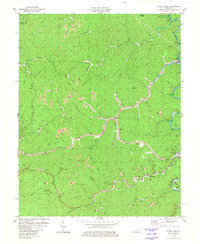
1980 Map of Hyden West
USGS Topo · Published 1980About this map
Hyden and the neighboring hills of Leslie Co and Perry Co are depicted during a period of significant coal extraction and infrastructure development. The landscape is heavily marked by numerous Strip Mine operations following the contours of the steep ridges above Middle Fork Kentucky River. The Daniel Boone Parkway, labeled as a Toll Road during this era, cuts through the center of the sheet, bridging the steep topography between Thousandsticks and Sizerock. Local life is anchored by family-named landmarks and essential services, including the Leslie County High Sch, Breckinridge Hospital, and the Sizemore Cem. Along the water, the Water Filtration Plant and a Drive-in Theater near Rockhouse Creek reflect the mid-century growth of these Appalachian communities before later environmental and economic shifts altered the terrain further.
Find a feature on this map
74 named features on this map. Tap any name to fly to it.
Don’t see what you’re looking for? This feature index may not catch every label — zoom into the map to look around manually.
Map Details
Editions of this 1980 Hyden West Map
This is the sole edition of this map. No revisions or reprints were ever made.
Other maps of this area

1891 · Manchester
USGS Topo · 1:125,000

1891 · Hazard
USGS Topo · 1:125,000

1913 · Buckhorn
USGS Topo · 1:62,500

1916 · Hyden
USGS Topo · 1:48,000

1919 · Hyden
USGS Topo · 1:62,500

1953 · Buckhorn
USGS Topo · 1:24,000

1953 · Hyden West
USGS Topo · 1:24,000

1953 · Big Creek
USGS Topo · 1:24,000

1953 · Mistletoe
USGS Topo · 1:24,000

1954 · Krypton
USGS Topo · 1:24,000