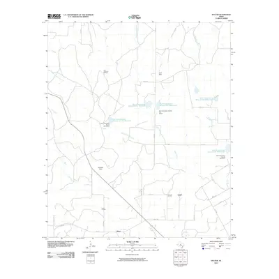
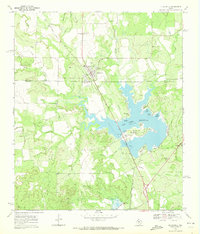
2010 Map of Hylton
USGS Topo · Published 2010About this map
Hylton anchors this West Texas landscape, positioned near the southern edge of a terrain defined by extensive watershed management and ranching features. The drainage systems of North Fork Valley Creek, South Fork Valley Creek, and Cottonwood Creek are punctuated by a series of Soil Conservation Service reservoirs and dams, reflecting a concerted effort to manage water in the arid Nolan County environment. Landmark features such as High Lonesome Windmill, Wolf Draw, and Magness Draw characterize the open country between a network of county roads. Local history is preserved at the Hylton Cemetery and Campbell Cemetery, while the presence of the Flying W Airport northeast of the main settlement points to the integration of aviation into this rural expanse. The road system, including FM 1170 and numerous numbered county routes like Co RD 310, connects these dispersed homesteads and landmarks across the prairie.
Find a feature on this map
37 named features on this map. Tap any name to fly to it.
Don’t see what you’re looking for? This feature index may not catch every label — zoom into the map to look around manually.
Map Details
Editions of this 2010 Hylton Map
This is the sole edition of this map. No revisions or reprints were ever made.
Other maps of this area

1893 · Sweetwater
USGS Topo · 1:125,000

1954 · Big Spring
USGS Topo · 1:250,000

1957 · Merkel
USGS Topo · 1:62,500

1958 · Big Spring
USGS Topo · 1:250,000
1967 · Shep
USGS Topo · 1:24,000

1967 · Hylton
USGS Topo · 1:24,000
1967 · Church Peak
USGS Topo · 1:24,000
1967 · Wingate
USGS Topo · 1:24,000

1969 · Blackwell NE
USGS Topo · 1:24,000
1969 · Blackwell
USGS Topo · 1:24,000