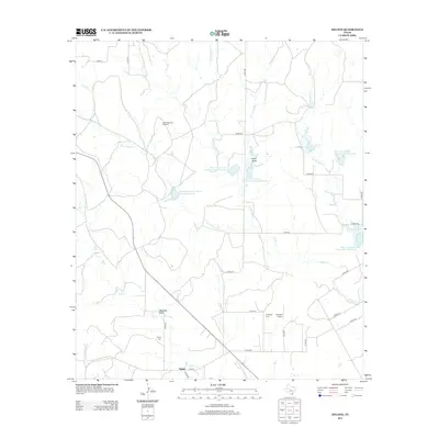
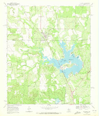
2012 Map of Hylton
USGS Topo · Published 2012About this map
The small settlement of Hylton anchors this West Texas landscape, which is defined by a network of drainage systems and conservation projects. The terrain is dominated by the upper reaches of Valley Cr, including the N Fork Valley Cr and S Fork Valley Cr. These watercourses are supported by numerous water management features, such as the Soil Conservation Service Site 5 Reservoir and the Soil Conservation Service Site 4a Reservoir. The landscape's ranching and agricultural character is evident in landmarks like the High Lonesome Windmill and Magness Draw. Local history and genealogy interests are represented by the Hylton Cem and Campbell Cem, located south and east of the main townsite. This era of the landscape also includes modern aviation facilities, specifically the Flying W Airport near the intersection of Co RD-261 and Co RD-312.
Find a feature on this map
34 named features on this map. Tap any name to fly to it.
Don’t see what you’re looking for? This feature index may not catch every label — zoom into the map to look around manually.
Map Details
Editions of this 2012 Hylton Map
This is the sole edition of this map. No revisions or reprints were ever made.
Other maps of this area

1893 · Sweetwater
USGS Topo · 1:125,000

1954 · Big Spring
USGS Topo · 1:250,000

1957 · Merkel
USGS Topo · 1:62,500

1958 · Big Spring
USGS Topo · 1:250,000
1967 · Shep
USGS Topo · 1:24,000

1967 · Hylton
USGS Topo · 1:24,000
1967 · Church Peak
USGS Topo · 1:24,000
1967 · Wingate
USGS Topo · 1:24,000

1969 · Blackwell NE
USGS Topo · 1:24,000
1969 · Blackwell
USGS Topo · 1:24,000