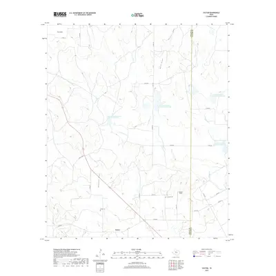
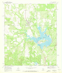
2019 Map of Hylton
USGS Topo · Published 2019About this map
Hylton anchors this modern topographic perspective of the West Texas landscape, situated along F.M. 1170 at the southern edge of the survey. The terrain is defined by the intricate drainages of S Fork Valley Cr and N Fork Valley Cr, which feed into several Soil Conservation Service reservoirs including Site 4a and Site 6. These engineered water features reflect the importance of water management in this arid region, where ranching and agricultural life depend on reliable catchment.
Find a feature on this map
37 named features on this map. Tap any name to fly to it.
Don’t see what you’re looking for? This feature index may not catch every label — zoom into the map to look around manually.
Map Details
Editions of this 2019 Hylton Map
This is the sole edition of this map. No revisions or reprints were ever made.
Other maps of this area

1893 · Sweetwater
USGS Topo · 1:125,000

1954 · Big Spring
USGS Topo · 1:250,000

1957 · Merkel
USGS Topo · 1:62,500

1958 · Big Spring
USGS Topo · 1:250,000
1967 · Shep
USGS Topo · 1:24,000

1967 · Hylton
USGS Topo · 1:24,000
1967 · Church Peak
USGS Topo · 1:24,000
1967 · Wingate
USGS Topo · 1:24,000

1969 · Blackwell NE
USGS Topo · 1:24,000
1969 · Blackwell
USGS Topo · 1:24,000