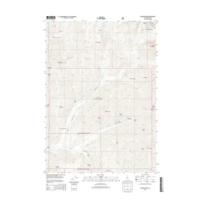
2013 Map of Hyndman Peak
USGS Topo · Published 2013About this map
Hyndman Peak towers over this section of the Pioneer Mountains within the Sawtooth National Forest. The landscape is defined by high-elevation drainage systems, where the E Fork Wood River and its many tributaries, such as Hyndman Cr and Cove Cr, carve through deep canyons. Historically, this area has served as a key recreation and backcountry destination, evidenced by the presence of Pioneer Cabin high on a ridge and several established campsites including Federal Gulch Campground and Sawmill Campground. The map reveals a complex network of named gulches and draws, like Paymaster Gulch and Hook Draw, which hint at the region's legacy of prospecting and resource extraction. Transportation is limited to rugged forest routes such as the Hyndman Creek Rd and E Fork Rd, which follow the natural contours of the river valleys.
Find a feature on this map
49 named features on this map. Tap any name to fly to it.
Don’t see what you’re looking for? This feature index may not catch every label — zoom into the map to look around manually.
Map Details
Editions of this 2013 Hyndman Peak Map
This is the sole edition of this map. No revisions or reprints were ever made.
Other maps of this area

1895 · Hailey
USGS Topo · 1:125,000

1897 · Hailey
USGS Topo · 1:125,000

1955 · Hailey
USGS Topo · 1:250,000

1959 · Hailey
USGS Topo · 1:250,000

1962 · Hailey
USGS Topo · 1:250,000

1967 · Rock Roll Canyon
USGS Topo · 1:24,000

1967 · Baugh Creek SW
USGS Topo · 1:24,000

1967 · Baugh Creek
USGS Topo · 1:24,000

1967 · Sun Valley
USGS Topo · 1:24,000
1967 · Grays Peak
USGS Topo · 1:24,000