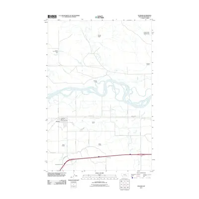
2011 Map of Hysham
USGS Topo · Published 2011About this map
The town of Hysham serves as a central hub in this Treasure County landscape, situated where the high plains meet the intricate channels of the Yellowstone River. The area’s agricultural and ranching foundations are evident in the complex irrigation and water management systems, including the Box Elder Ditch and several livestock-focused impoundments like the Froze-to-Death Land Company Number 1 Dam and Grierson Number 1 Dam. These features illustrate the vital role of water rights in this arid Montana environment.
Find a feature on this map
32 named features on this map. Tap any name to fly to it.
Don’t see what you’re looking for? This feature index may not catch every label — zoom into the map to look around manually.
Map Details
Editions of this 2011 Hysham Map
This is the sole edition of this map. No revisions or reprints were ever made.
Other maps of this area

1954 · Forsyth
USGS Topo · 1:250,000

1957 · Forsyth
USGS Topo · 1:250,000

1958 · Forsyth
USGS Topo · 1:250,000

1960 · Hysham
USGS Topo · 1:24,000

1960 · Steie Ranch
USGS Topo · 1:24,000

1960 · Vananda
USGS Topo · 1:24,000

1960 · Ahles
USGS Topo · 1:24,000

1960 · Myers
USGS Topo · 1:24,000

1960 · Sanders
USGS Topo · 1:24,000

1960 · Eldering Ranch
USGS Topo · 1:24,000