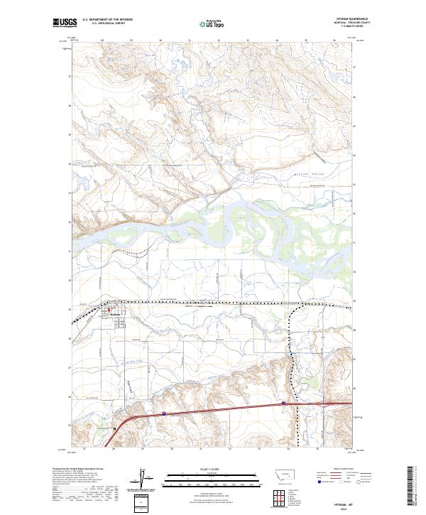
2024 Map of Hysham
USGS Topo · Published 2024About this map
Hysham serves as the seat of local government, centered on the Treasure County Courthouse and a grid of streets including Pioneer Ave and Elliott Ave. The landscape is defined by the sweeping course of the Yellowstone River, which anchors an extensive network of irrigation infrastructure critical to the region's agricultural life. This system includes the Hysham Main Canal, Yellowstone Canal, and Box Elder Ditch, tracing the contours of the valley floor. To the north, the terrain rises into Mission Valley, dissected by coulees and creeks with evocative names like Froze to Death Creek. South of the town center, Memorial Vale Cem sits near the Hysham Re-Lift Canal, illustrating how modern water management and local heritage intersect in this Treasure County community.
Find a feature on this map
51 named features on this map. Tap any name to fly to it.
Don’t see what you’re looking for? This feature index may not catch every label — zoom into the map to look around manually.
Map Details
Editions of this 2024 Hysham Map
This is the sole edition of this map. No revisions or reprints were ever made.
Other maps of this area

1954 · Forsyth
USGS Topo · 1:250,000

1957 · Forsyth
USGS Topo · 1:250,000

1958 · Forsyth
USGS Topo · 1:250,000

1960 · Hysham
USGS Topo · 1:24,000

1960 · Steie Ranch
USGS Topo · 1:24,000

1960 · Vananda
USGS Topo · 1:24,000

1960 · Ahles
USGS Topo · 1:24,000

1960 · Myers
USGS Topo · 1:24,000

1960 · Sanders
USGS Topo · 1:24,000

1960 · Eldering Ranch
USGS Topo · 1:24,000