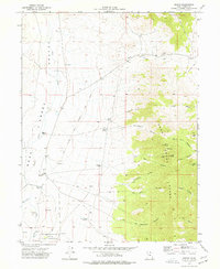
1973 Map of Ibapah
USGS Topo · Published 1977About this map
Ibapah sits as the primary settlement in this western desert corridor, located near the Goshute Indian Reservation boundary and the expansive Deep Creek Valley. This area preserves a critical segment of the Pony Express Overland Stage Route, tracing the historic path across the flats toward the rising slopes of the Deep Creek Range. The landscape is a study in desert water management, punctuated by vital water sources like Greasewood Spring, Chadman Spring, and Secret Spring that once dictated the movement of travel and livestock.
Find a feature on this map
40 named features on this map. Tap any name to fly to it.
Don’t see what you’re looking for? This feature index may not catch every label — zoom into the map to look around manually.
Map Details
Editions of this 1973 Ibapah Map
3 editions found
Other maps of this area

1908 · Fish Springs
USGS Topo · 1:250,000

1910 · Fish Springs
USGS Topo · 1:250,000

1925 · Gold Hill
USGS Topo · 1:62,500

1928 · Gold Hill
USGS Topo · 1:62,500

1953 · Tooele
USGS Topo · 1:250,000

1953 · Delta
USGS Topo · 1:250,000

1955 · Tooele
USGS Topo · 1:250,000

1955 · Elko
USGS Topo · 1:250,000

1956 · Ely
USGS Topo · 1:250,000

1958 · Elko
USGS Topo · 1:250,000