
1933 Map of Iberia
USGS Topo · Published 1963About this map
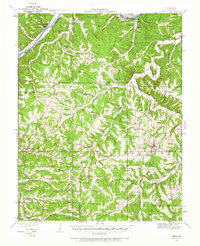
Tuscumbia and the winding Osage River anchor this 1930s survey of central Missouri, illustrating a landscape defined by deeply incised river valleys and rural plateaus. The settlement pattern is characterized by small interior hubs like Iberia and Brumley, connected by a dense network of country schools such as Spearman Sch, Honey Spring Sch, and Lurton Sch. This era captures the county just as a high-voltage transmission line began to cut across the township of Equality, signaling modern utility expansion into a region still largely reliant on local community centers.
Find a feature on this map
89 named features on this map. Tap any name to fly to it.
Don’t see what you’re looking for? This feature index may not catch every label — zoom into the map to look around manually.
Map Details
Editions of this 1933 Iberia Map
2 editions found
Other maps of this area

1888 · Versailles
USGS Topo · 1:125,000

1888 · Tuscumbia
USGS Topo · 1:125,000

1893 · Versailles
USGS Topo · 1:125,000

1894 · Tuscumbia
USGS Topo · 1:125,000

1904 · Eldon
USGS Topo · 1:62,500

1932 · Versailles No 4
USGS Topo · 1:48,000

1933 · Stoutland
USGS Topo · 1:62,500

1934 · Toronto
USGS Topo · 1:24,000

1934 · Bagnell
USGS Topo · 1:24,000
1935 · Eldon
USGS Topo · 1:24,000