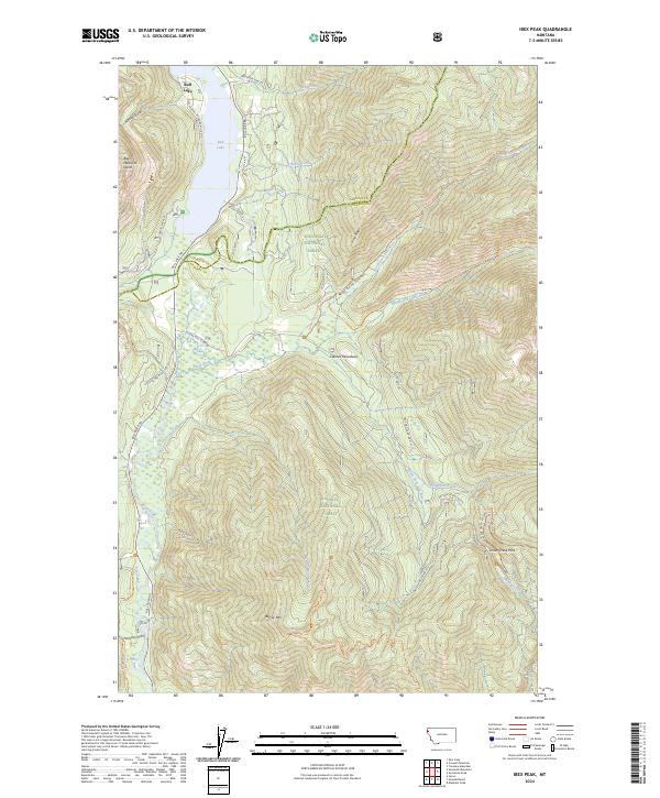
2024 Map of Ibex Peak
USGS Topo · Published 2024About this map
Bull Lake anchors the northwestern corner of this map, where the mountain waters of Payne Creek and Upham Creek meet the valley floor. The landscape is a complex intersection of administrative and wilderness boundaries, marking the division between the Kootenai National Forest and the Kaniksu National Forest, as well as the transition into the protected high country of the Cabinet Mountains Wilderness. To the south, the terrain is dominated by the massive Berray Mtn and the steep granite features of Bad Medicine Spires. A network of Forest Service roads and primitive trails, including the North Fork Bull River Trl and Dry Creek Trl, traces the narrow drainages of the Bull River watershed. This topographic study captures a remote Montana landscape defined by its river forks and high-altitude crossings like Snake Creek Pass.
Find a feature on this map
43 named features on this map. Tap any name to fly to it.
Don’t see what you’re looking for? This feature index may not catch every label — zoom into the map to look around manually.
Map Details
Editions of this 2024 Ibex Peak Map
This is the sole edition of this map. No revisions or reprints were ever made.
Other maps of this area

1920 · Libby
USGS Topo · 1:125,000

1930 · Libby
USGS Topo · 1:125,000

1932 · Libby
USGS Topo · 1:125,000

1957 · Kalispell
USGS Topo · 1:250,000

1960 · Kalispell
USGS Topo · 1:250,000

1961 · Kalispell
USGS Topo · 1:250,000
1963 · Spar Lake
USGS Topo · 1:24,000

1963 · Treasure Mountain
USGS Topo · 1:24,000
1963 · Crowell Mountain
USGS Topo · 1:24,000
1966 · Ibex Peak
USGS Topo · 1:24,000